
What is IIIF?
IIIF—the International Image Interoperability Framework, pronounced “Triple-Eye-Eff”—provides open standards for sharing digital collections. Libraries, archives, and museums use IIIF to make images and information about their collections available through a common set of APIs.
This lets applications such as Allmaps work with maps from many institutions. Each institution hosts its own images, while IIIF provides a shared way to access them.
You don’t need to understand the technical details to use Allmaps, but two IIIF APIs and a few terms are useful to know.
IIIF Presentation API
The Presentation API describes digital objects and how their parts fit together:
- A Manifest is a JSON document describing an object, such as a map or an atlas. It includes descriptive information and an ordered sequence of Canvases.
- A Canvas is a virtual surface representing a page or view of that object. A single-sheet map might have one Canvas; an atlas might have one for each page.
- An Annotation connects content to a Canvas. A painting annotation specifies the image to display on it. Other annotations can add information, such as comments or transcriptions.
See the IIIF Presentation API documentation for more detail.
IIIF Image API
The Image API lets applications request an entire image or a region of it at a particular size, rotation, quality, and format. This makes it possible to explore large images without downloading the full-resolution image at once.
Image requests follow this pattern:
[image service base URL]/[region]/[size]/[rotation]/[quality].[format]
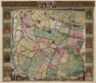
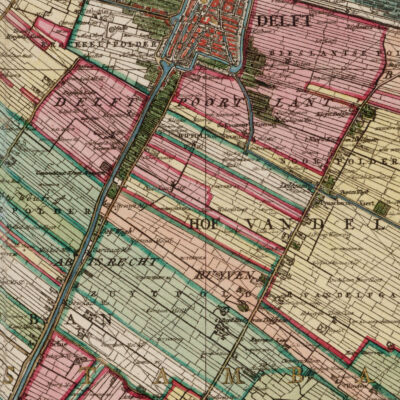
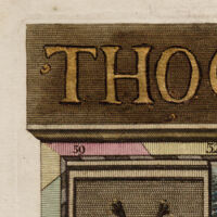
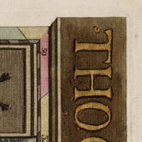
The examples below use a map of Delfland. Click a URL suffix to open the requested image.
| Preview | Request |
|---|---|
|
Full map
The entire image, scaled to 400 pixels wide. /full/
|
|
Map detail
A 1557 × 1557 pixel region starting at (4316, 4389), scaled to 400 pixels wide. /4316,4389,1557,1557/
|
|
Upper-left corner
A 1000 × 1000 pixel region starting at (0, 0), scaled to 200 pixels wide. /0,0,1000,1000/
|
|
Rotated corner
The same region and size, rotated 90° clockwise. /0,0,1000,1000/
|
Each image service also provides an
info.json
document describing the image’s dimensions and the service’s capabilities,
including available tile sizes and scale factors. Supported features vary
between services.
See the IIIF Image API documentation for more detail.